
SW US Trip with Marion C. and Sue Hope
Moab Utah, Stop 14
May 30 - Day 18 - Bryce to Moab
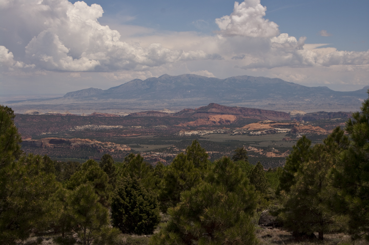
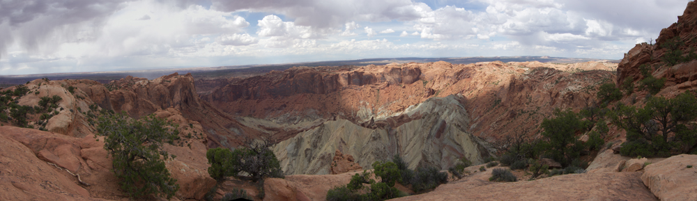
Bidding Bryce Canyon a fond adieu, we turned toward Moab for Arches and Canyonlands National Parks. In order to get to Moab, we had to cross part of the Grand Staircase Escalante and through Capital Reef National Park. Both of which were scenic.
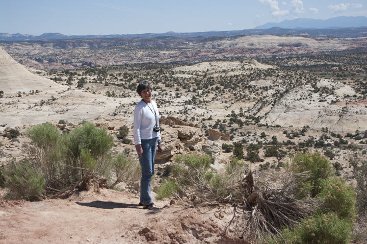
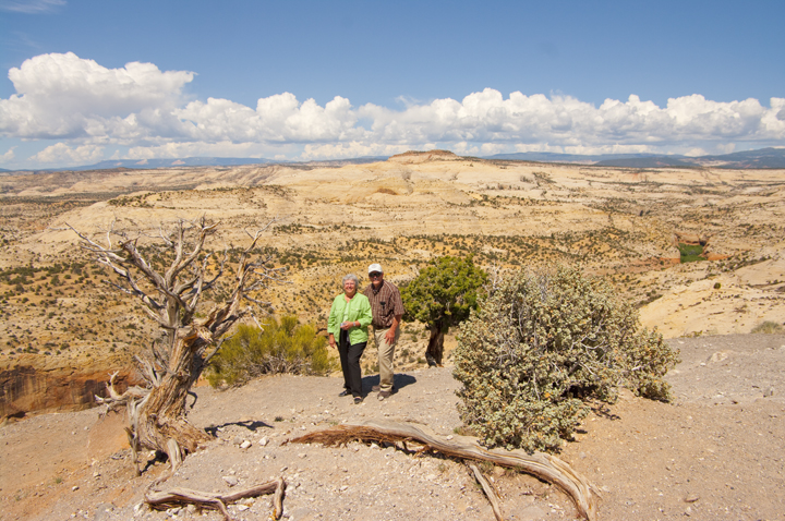
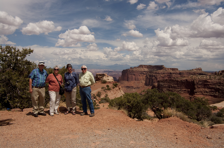
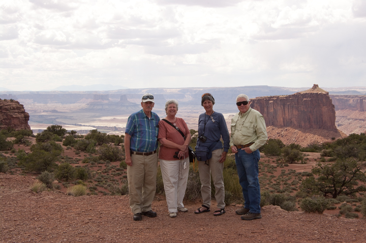
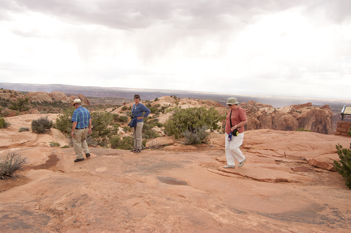
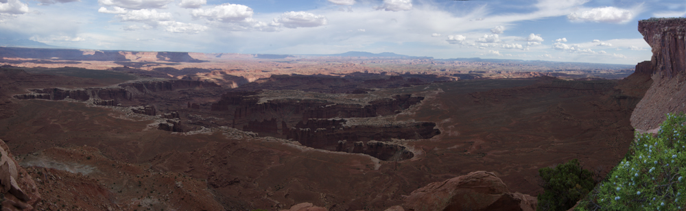
Dot at one and Marion Cone and Sue at another of the overlooks.
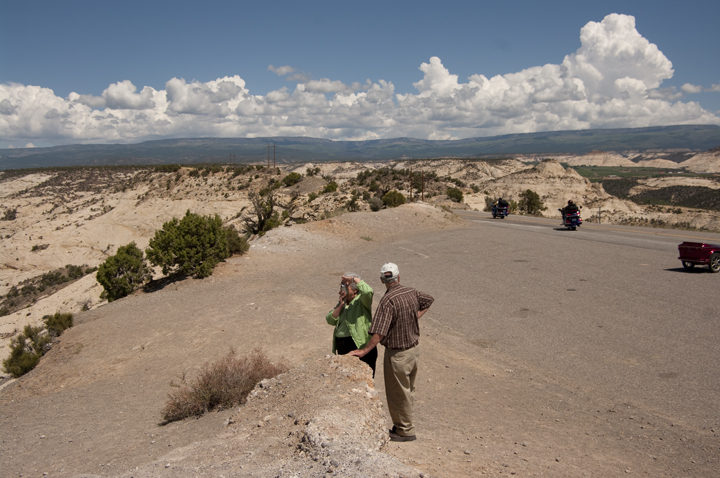
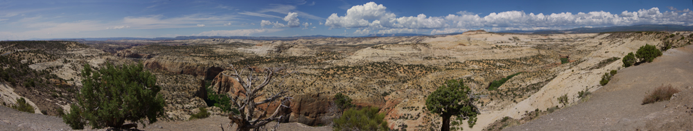
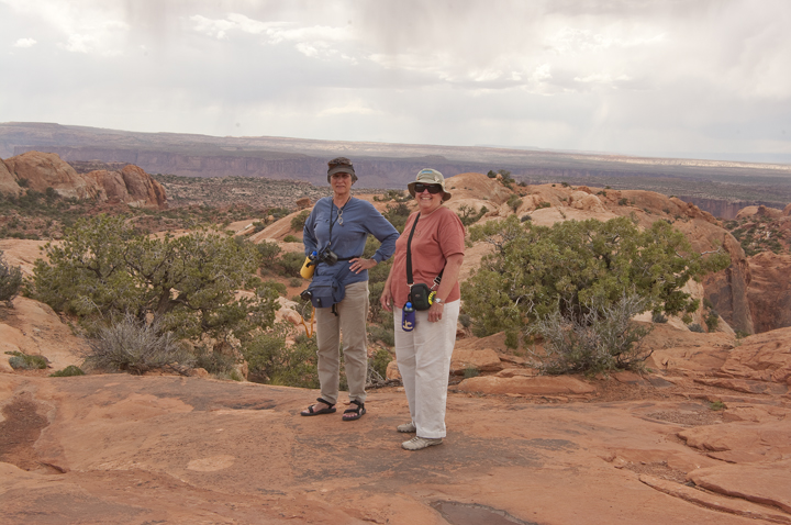
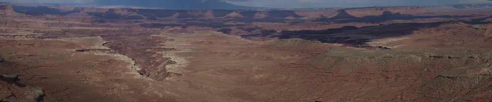
Dot, Marion Cone and Sue at the overlook from which the panorama above was taken.
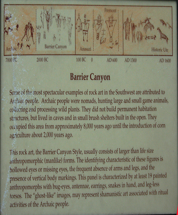
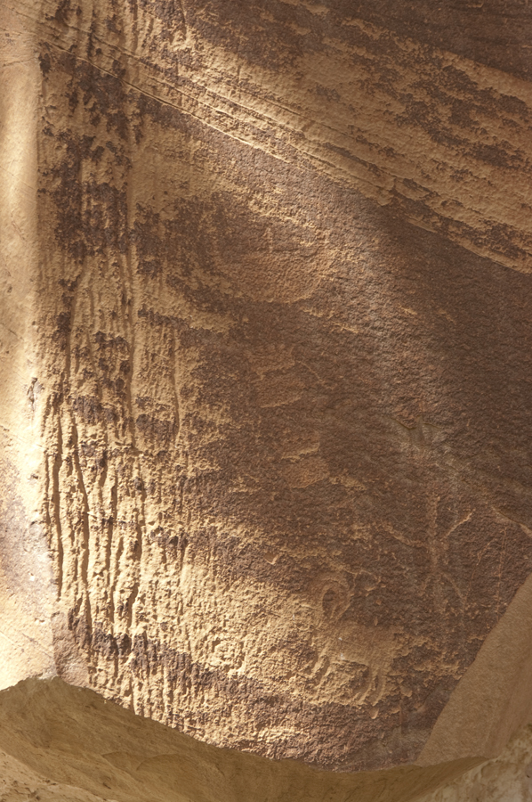
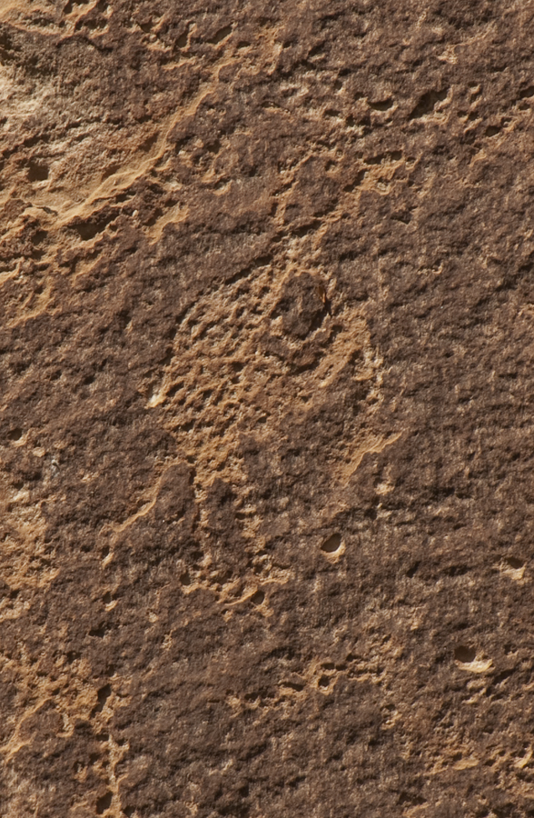
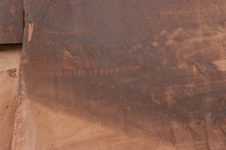
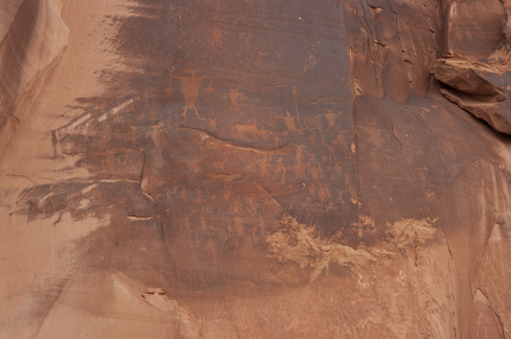
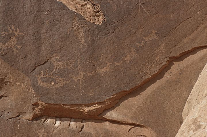
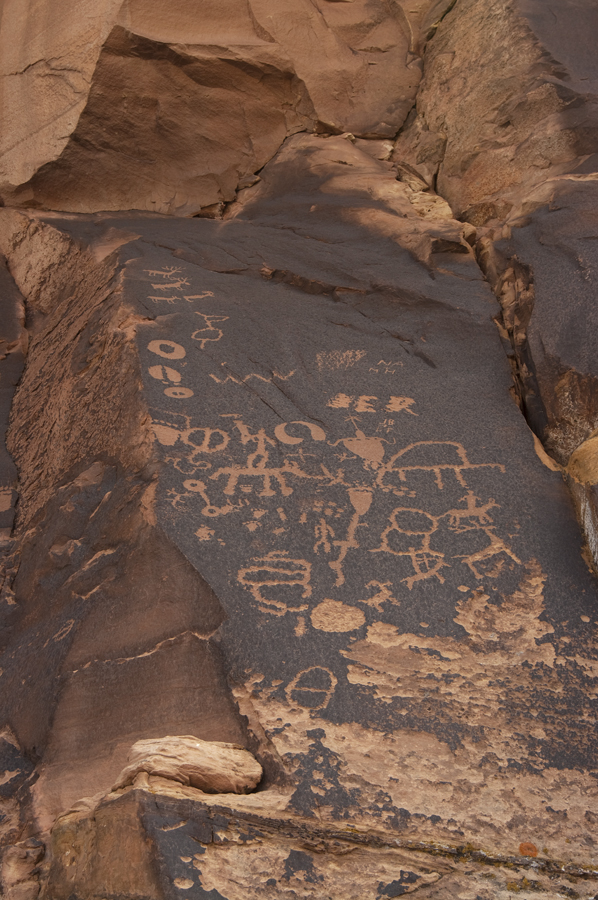
The main reason we stopped in Capitol Reef was to see some of the rock art there. Rock art or Indian writing used at least two different mediums. Some - perhaps most - examples are called petroglyphs and are chipped or pecked into the patina of the rock face. This patina is a dark, thin layer of mineral deposits leached onto the surface of the rock face over many hundreds of years. A second form, called pictographs, involves images painted onto the rock faces using native colorants or stains. Rock art styles correspond to both dates and locations. The scheme in this area along the Colorado River seems to suggest that the first Indians, the Paleo Indians have no known rock art identified with them. Most rock art dates from from the Archaic Period (ca., 7000BC to ca., 2000 BC), through the Barrier Canyon period (ca., 2000 BC to ca., 200 AD), the Anasazi and Fremont periods (ca., 200BC to ca., 1300 AD) up to the Historical period which dates from about 1540 when the Spanish introduced horses to America. There are, of course, about as many dating schemes as there authors who write about rock art. Some consider the Archaic period to subsume the Barrier Canyon period and others find different dates for the Anasazi and Fremont periods. The photo below is a display near one on the rock art sites we visited on an earlier trip. It gives a general overview of the dates of some of the local rock art styles.
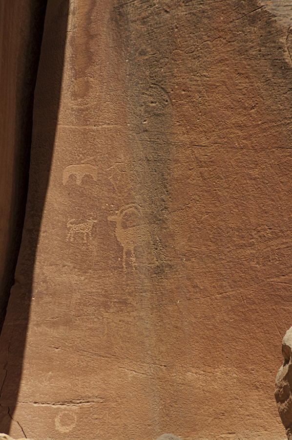
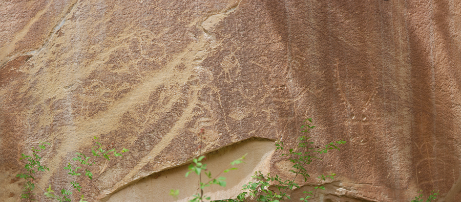
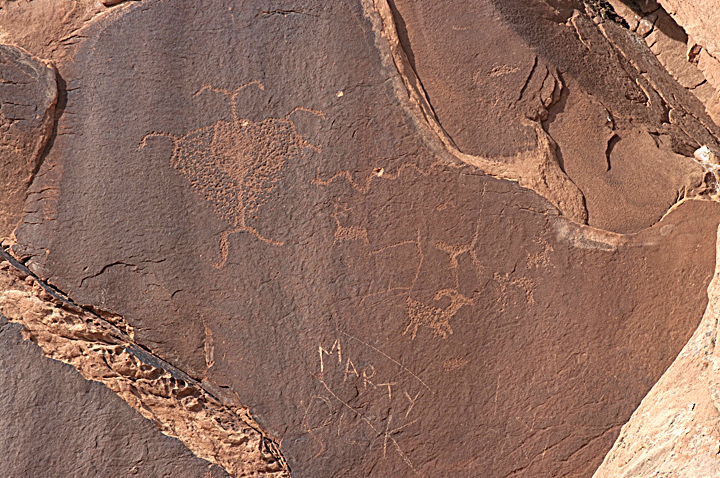
Some of the rock art or Indian writing from Capitol Reef National Park is shown below.
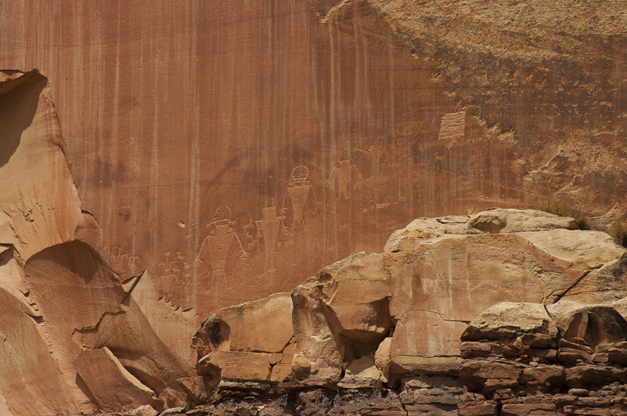
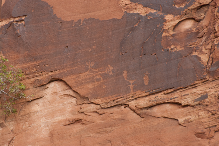
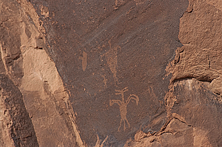
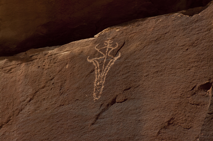
This section is especially interesting. There is a ancient myth (?) about a being called the Kokopelli. This figure, in one of its many variations, can be found from the southern tip of South America to Canada. He is ascribed the power to distribute babies, control the reproduction of game animals, and other similar reproductive functions. He is depicted as a flute playing hunchback with elaborate feathers on his head. There are numerous explanations or speculations as to where and how this myth began. One suggests that he was a feather trader from Central America and played his flute to warn the villagers that he was approaching so as not to startle them. The hump on his back is ascribed to his pack of feathers. He reportedly played a role in helping to avoid inbreeding in these isolated communities by servicing the village females. This may be the origin of the concept of Kokopelli as a fertility symbol. Anyway, the central figure below is an example of a Kokopelli petroglyph.
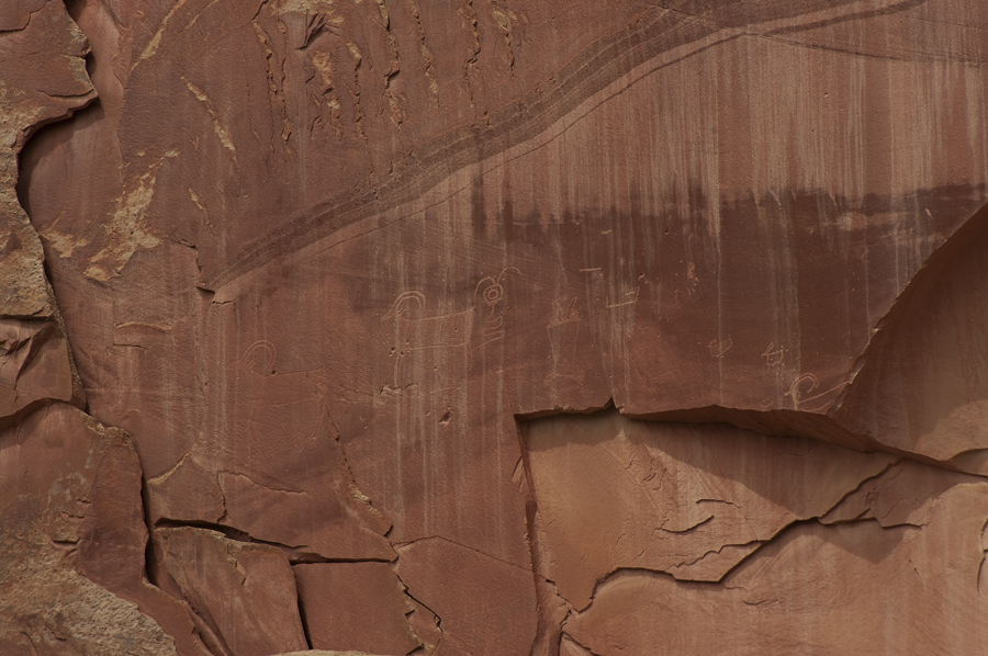
And here's a close up taken from the image above and the stylized version seen frequently in the south west and on products from that region.

We wended our way on to Moab where we would stay while accessing Arches and Canyonlands National Parks. We checked into the hotel and had dinner, then turned in.
May 31 - Day 19 - Miscellaneous Attractions Around Moab
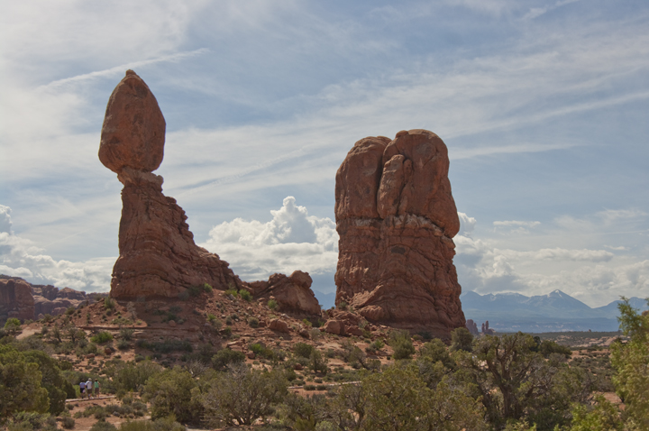
Up the next morning, Sunday, and had the continental breakfast at the hotel (not very good!). We first went to the visitor's center in Moab to find where some places we knew about were located. We found the directions in the literature available there, then rode out to Arches while discussing what we would do today. We rode into Arches for some distance, then decided we didn't really feel like hiking to see the Arches' interesting geological features, so decided on a miscellany of other interesting features in the area. We did get a look at the balanced rock in Arches before leaving though.
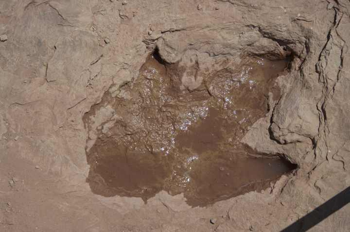
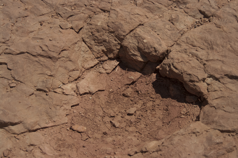
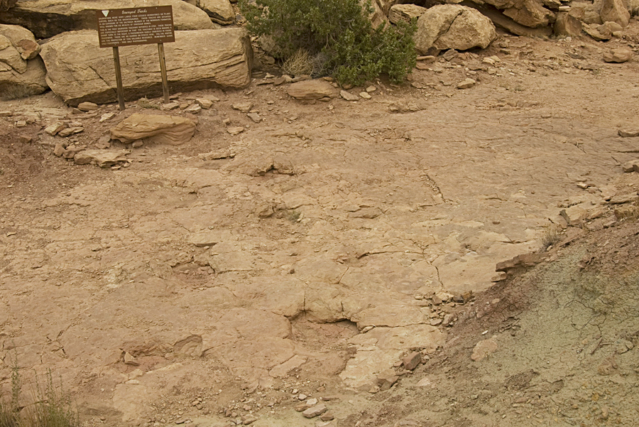
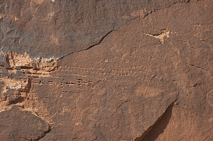
We decided to go, first, to Copper Ridge where there are fossilized dinosaur tracks in an ancient stream bed that is now rock. There are reportedly tracks of about six dinosaurs crossing the stream bed. We could identify two sets easily. The first were those of a three toed carnivorous dinosaur thought to be an Allosaurus and are shown immediately below.
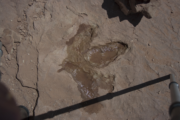
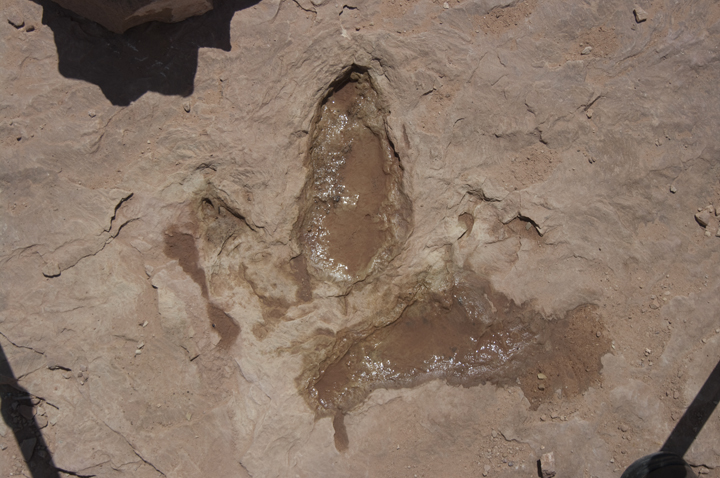
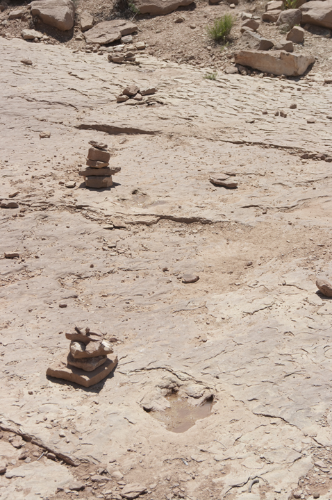
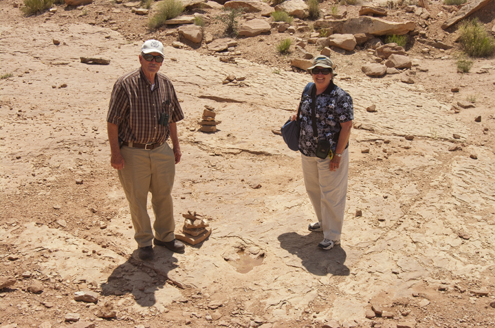
The path across the stream bottom is shown here. The small piles of stones are placed beside each of the individual tracks above. The second photo shows Marion Cone and Sue beside the best of the tracks and illustrate that the stride of the animal was about seven or eight feet.
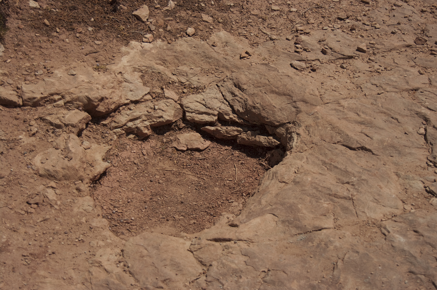
A second set of tracks were supposedly from a Brontosaurus. Frankly, these just looked like holes in the rock but they did follow a path that turned while crossing and followed the stream bed for a short distance. Had we been standing where I was when I took the third photo below, we would have been crushed by the Brontosaurus (grin).
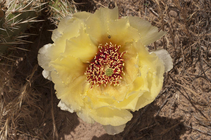
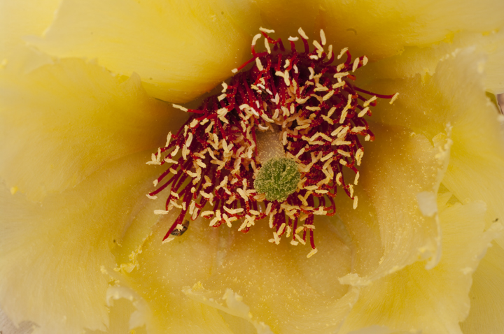
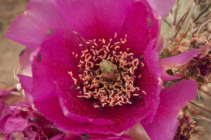
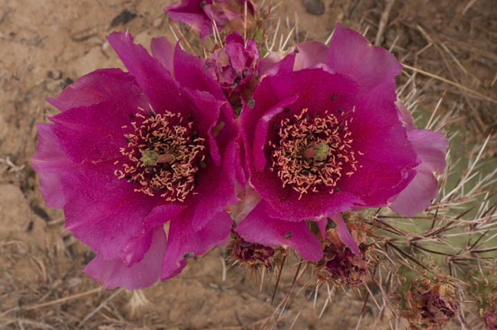
There were many cactus blooming across the desert on the way to and around the dinosaur trackway.
After a quick lunch back at Moab, we proceeded to do a tour of the area to check out more rock art or Indian writing. First, we went to look at Courthouse Wash. This is a very old set of pictographs from around 2000 BC. They were vandalized in 1980 when some mindless idiot used wire brushes and chlorine bleach to try to remove them. They can still be seen though. I didn't take any photographs because we didn't want to climb up to the cliff face where they were located but you can see them from the walk along side the cliffs at highway level. These are classified as Barrier Canyon forms.
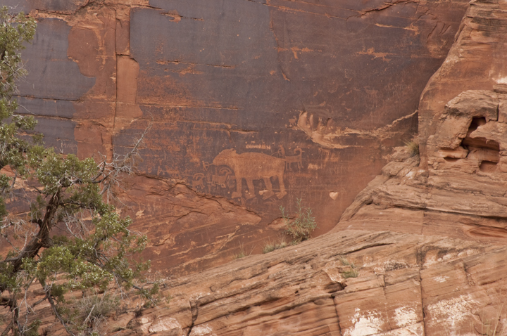
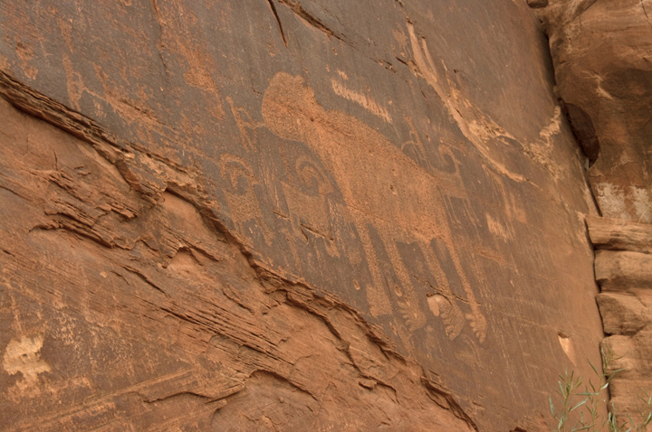
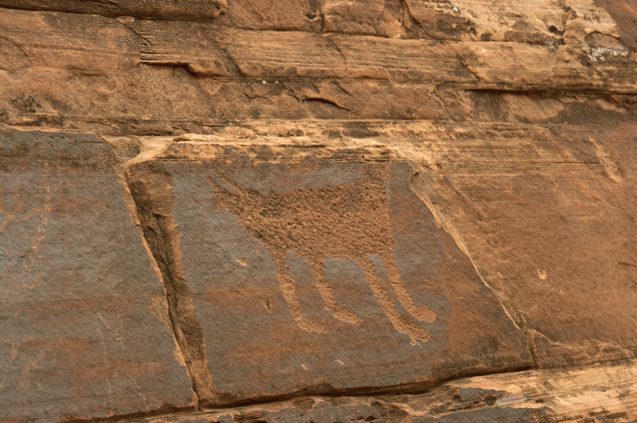
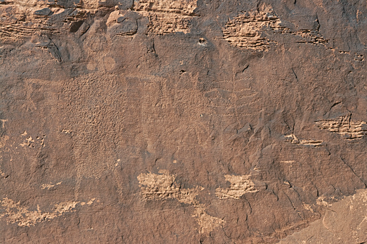
We next went to another site along the Colorado River just north of Moab where rock art is found. The first pair of photos below is of a bear depiction (same one - two views). Bears aren't found often in the rock art we have seen.
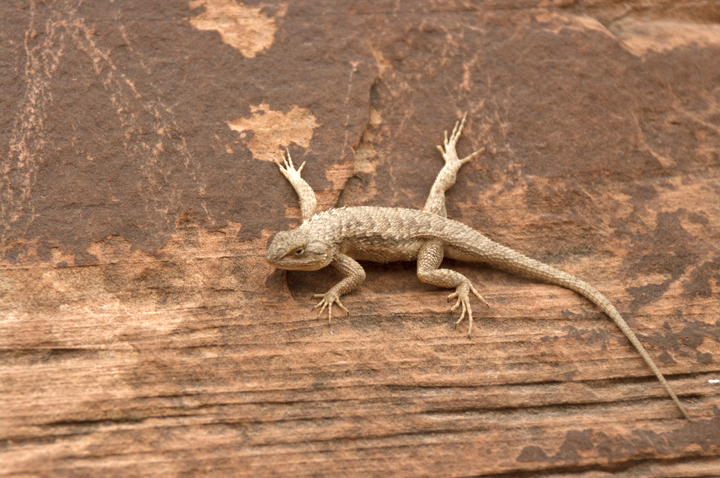
When I was climbing around photographing the bear above, this lizard was just sitting there checking me out so I got a few shots of him as well
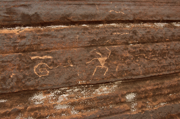
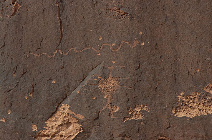
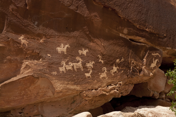
Next, we went to the other side of Moab to the "Golf Course Site". This is a subdivision associated with a golf course which has a panel of rock art among the properties. These figures date from about 750 to 2000 years ago. There are both Fremont (earlier) and and Ancestral Puebloan figures. The first of the photos below is of a bit of rock art called reindeer and sleigh because of its appearance. Also, there are a few "odd" figures below that might be overlooked. The row of dots has a special meaning, generally believed to represent footprints and indicate a path or track taken by the tribe or person. The humanoid figure in the lower left photo is known as Moab Man. I think most authorities believe these figures are probably Shamans or other magical humanoid entities.
After a day of hunting down dinosaur tracks and rock art, we headed back to Moab, had dinner at the Slick Rock Cafe and went back to the hotel, then to a local laundromat. After a frustrating evening moving between laundromats to get our clothes washed and dried, we went back to the hotel and hit the sack.
June 1 - Day 20 - Arches and Canyonlands National Parks.
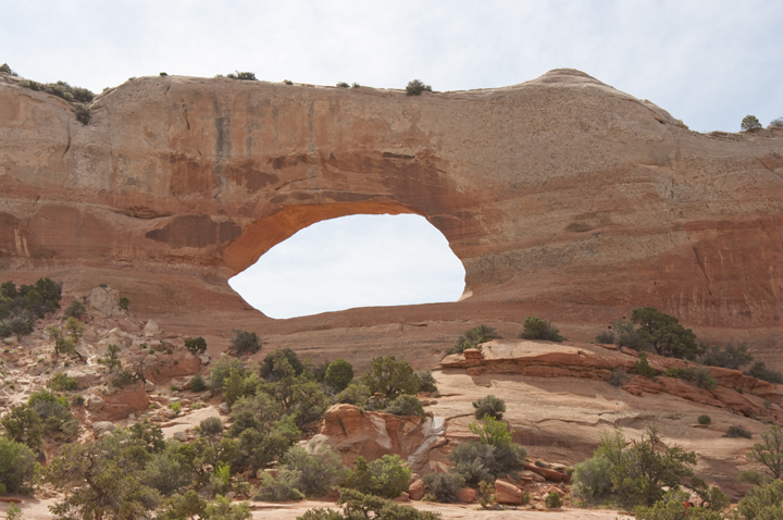
Next morning, we had the continental breakfast at the hotel (unimproved from yesterday) and headed out for a drugstore (did I say the breakfast wasn't very good - grin). After a shopping jaunt at Walker's Drugstore (drugs and everything else - great store), we decided to drive to the Needles District of Canyonlands to see Newspaper Rock, a really "busy" rock art site. Along the way, we spotted this arch. It was of special interest to Sue because it was named the Wilson Arch.
Newspaper Rock is a fascinating collection of Indian writing as seen below.
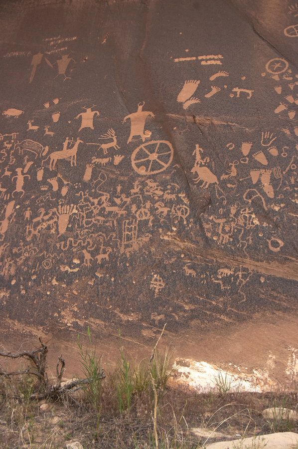
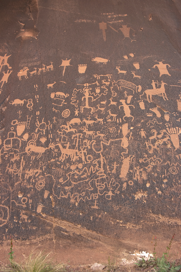
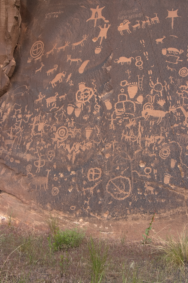 b>
b>
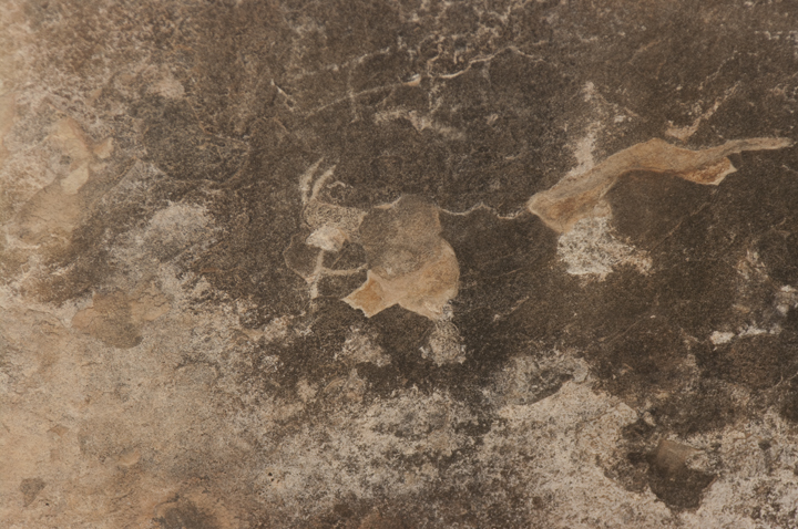
There was also a somewhat worse for wear Kokopelli at Newspaper Rock.
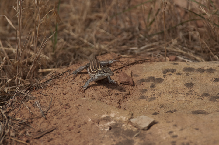
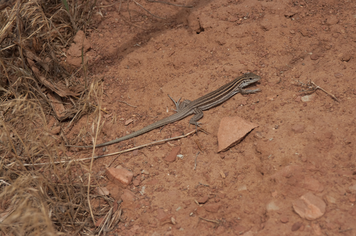
These whiptails were running around all over the area around Newspaper Rock.
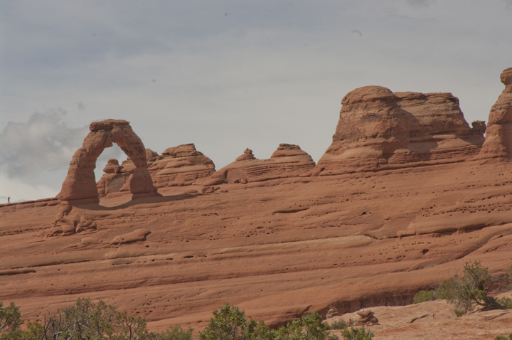
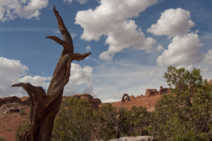
Having taken in Newspaper Rock, we headed back to Moab for lunch at a local sandwich shop and then out to Arches. We decided we had a day and a half of relaxed sight seeing so we ought to do some hiking today. We elected to check Wolf Ranch, an old ranch homestead with some rock art nearby, then hike up to the lower Delicate Arch viewing point. The Delicate Arch is the signature arch for Arches National Park and one of the symbols of the state of Utah.
First, the Wolf Ranch rock art. This is apparently recent (well, relatively) because you can see numerous men on horseback which means these were done after the horse was introduced around 1540 AD.
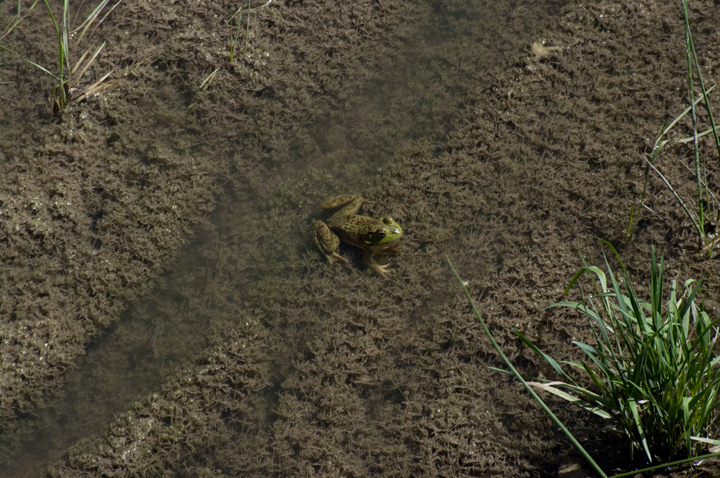
To get to the Wolf Ranch from the parking lot, you must hike a short distance and cross a bridge over a small stream. This stream, by the way, apparently does carry a considerable amount of water at times as there was major flooding here that caused access to the Arch to be closed in 2006. Anyway, this little guy was enjoying the cool water in the stream.
After Wolf Ranch and the rock art, we hiked back to the parking lot and drove around to the trail head for the lower Delicate Arch viewing point. The hike up to the viewing point is only a couple of miles round trip but it is a fairly steep climb. We make it though and the view of the Delicate Arch across a ravine was worth it.
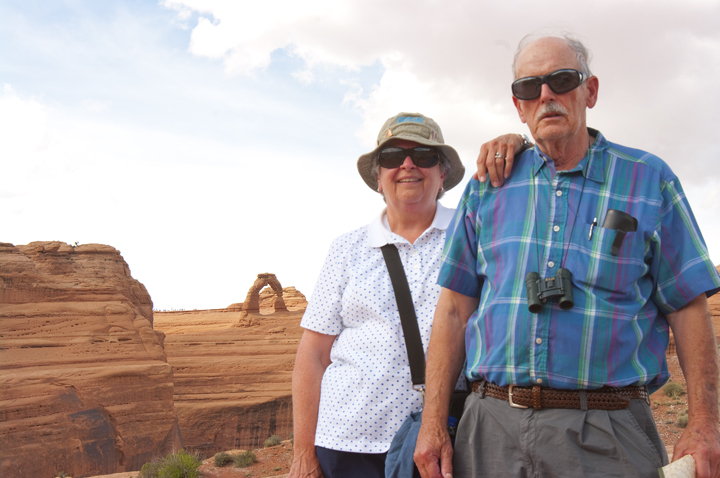
Marion and Sue with the Delicate Arch in the background.
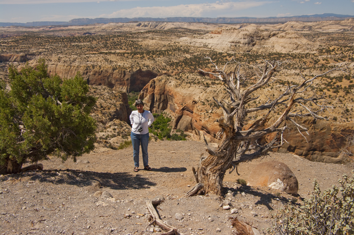
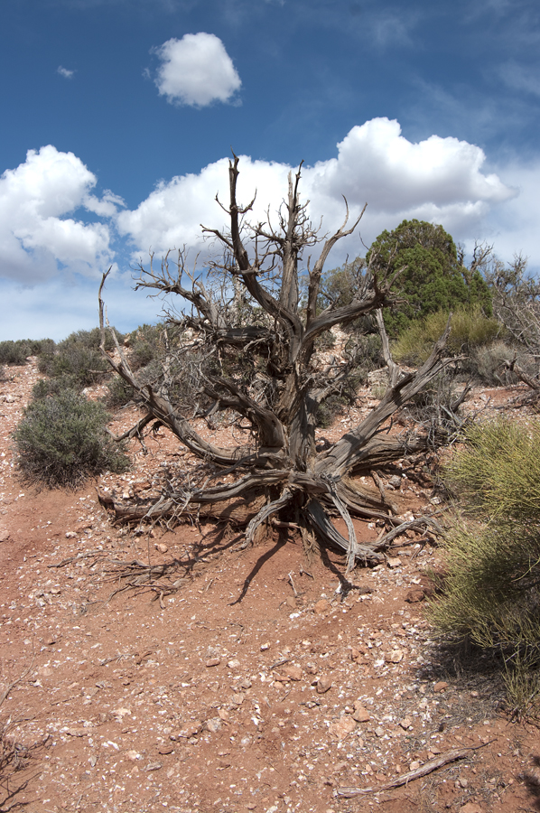
Another stark dead tree against the sky - one of my favorite subjects.
After returning from the Delicate Arch viewing area, we decided to take a drive out the Cache Wash trail - a 2WD driving trail that begins at the parking lot. We drove out it about a half mile only to find it blocked. We returned to Moab, had dinner and went back to the hotel for the night.
June 2 - Day 221 - Canyonlands National Park.
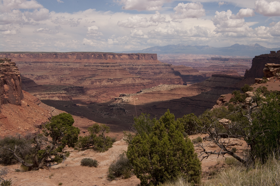
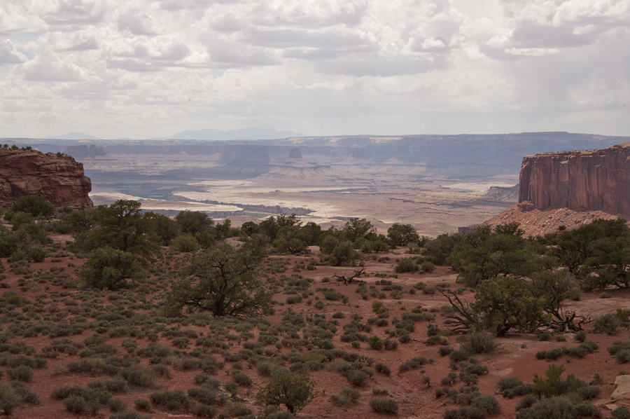
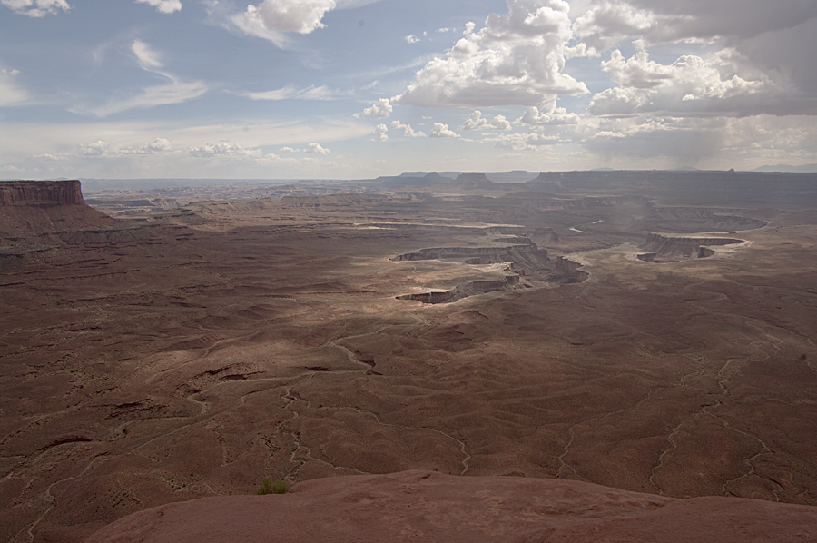
Had breakfast at the Pancake Haus, then went back to the Visitors' Information Center again. We decided to ride up to the Island In The Sky district of Canyonlands and check out some of the overlooks and maybe hike to some of the scenes. We stopped at a couple of overlooks between the entrance and the Visitor's Center. I don't remember which ones they were but here are some photos from each.
We stopped at the Visitor's Center and took in a lecture on animal features and their application, then headed on up the Grand View Drive. We turned onto the side road to Upheaval Dome to take a look at this feature. The Upheaval Dome is interesting. It is crater with a central upwelling of rock that is unusual the area. Geologists aren't sure how it was formed. The two theories are (1) and ancient salt dome that has eroded away leaving the stalk and (2) a meteor impact crater with all the traces of the meteor having been eroded away. At any rate, we hiked up to the rim to see it.
Here we are walking around on the rim and Dot and Sue are posing.
On the way back to the main park drive, Grand View Point Drive, we decided to turn off to the Green River Overlook and take a look at Soda Springs Basin.
The next stop was the Buck Canyon Overlook where we had a view down the South Fork to Buck Canyon.
We reached the end of the drive at Grand View Point and enjoyed this view of Monument Basin.
After making the run out the Grand View Point Drive, we headed back to Moab, getting back around 6:30 PM. After dinner at a local Mexican restaurant, we perused a local rock shop, then turned in. Tomorrow we drive down to Cortez, Colorado to see Mesa Verde (ruins of an ancient pueblo) and visit a newly found cousin.